Wednesday, April 28, 2010

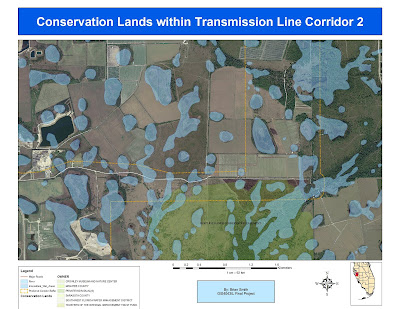
Bobwhite-Manatee Transmission Line Project


I used several maps and Google Earth to display different aspects of the corridor. 

Sunday, April 11, 2010

Week 11 Deliverables

final_CitiesAndRoads.jpg. Depicts interstates and state hwys along with major cities by population.


final_Recreation.jpg. Names water bodies along with paddling trails with access and Bird sanctuaries.

"Wild Map" From 3D Analyst with different perspective shots (180) over a valley.


ReclassVeg2.jpg. Showing the aspect layer that was created using ArcMap. 


ReclassVeg2.jpg.  

Sunday, April 4, 2010

Saturday, March 6, 2010

University of West Florida

UWF with new vectors...

UWF Vectors with Rectified Images

I had trouble when trying to size the image to fit the data frame, thinking I should have just subset it and then tried it. The RMS was low so I believe that I am getting better at it. For the north image my RMS was 8.6 and for the south it was 10.

Saturday, February 27, 2010

Miami -Dade County in Albers Conic

With all the trouble with TS this week after a whole Saturday I have created this eyesore! It's 1:11am here in Chesapeake, VA so I hope no one sees this so called map. Parks, Roads, Hydro, Urban areas, Wetlands and Habitat Conservation areas. Though Wetlands still will not show up. All vectors overlay NED elevation data.

Thursday, February 25, 2010

US Choropleth Map

AI Map to come once I find out how to manipulate it correctly.

Tuesday, February 2, 2010

Week 3 Mexico Population and Elevation Maps


Populations Across Mexico Week3_map1

Week3_map2


Mexican Elevation Week3_map3

Friday, January 29, 2010

Countries By Population

I have found the answer to right clicking in the TOC, by pressing shift+control+clicking your mouse.

Thursday, January 21, 2010

Proposed Youth Center Sites


I made a folder for this map would show up as a folder to select from. Also for the MAC users to right click you hold control+click but in ArcMap it does not work. option+z= zoom in, option+x= zoom out, option+c=pan. If anyone finds out how to right-click please tell me. I could only highlight the proposed sites.                                                              

Wednesday, January 20, 2010

San Diego Zoo


This map shows tourist locations in San Diego with all lines of commuication         .